Journey to Danville
Welcome to the Journey to Danville
The following is the story of how a group of Danville researchers proved and documented the true location of the Town of Danville. The members of that group included, Karen Hett, Karen “Candy” Lucas Williams, David Frame, Elsa Vorwerk, Bill Wood and Carolyn Terrell.
Finding Danville –
At the entrance to the Danville Section of Shepard Hill Cemetery is a historical marker which gives an impression that the cemetery site was actually the location of the now-extinct town of Danville. There is no doubt that the cemetery was used as a family burial ground for some of the early settlers in the Danville area and would have been considered to be in or at least on the outskirts of the town of Danville, but it has been proven through deeds and other historical records that the actual Town Lots were “around the corner and down the road a piece,” as we Texans would say. They were situated on both sides of present-day Old Danville Road, then known as Main Street, about half way between pd Shepard Hill to the south and pd West Danville to the north. Following is the story of how a group of Danville researchers proved and documented the true location of the Town of Danville. The members of that group were: Karen Hett, Karen “Candy” Lucas Williams (formerly Lawless), David Frame, Elsa Vorwerk and her husband, Bill Wood, and Carolyn Terrell. There were many others who contributed information from time to time or just cheered us on, including Gladys and Clifford May, Christine Hyman, Melinda Cagle, and many others.
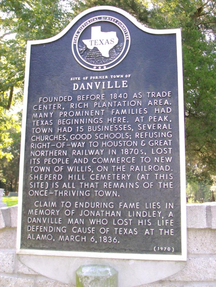
The following articles are the basis of the research that was done by Karen “Candy” in the finding of the exact location of Danville. Her research spans from 2009 – 2020.
Discovery of Hiram’s Well –
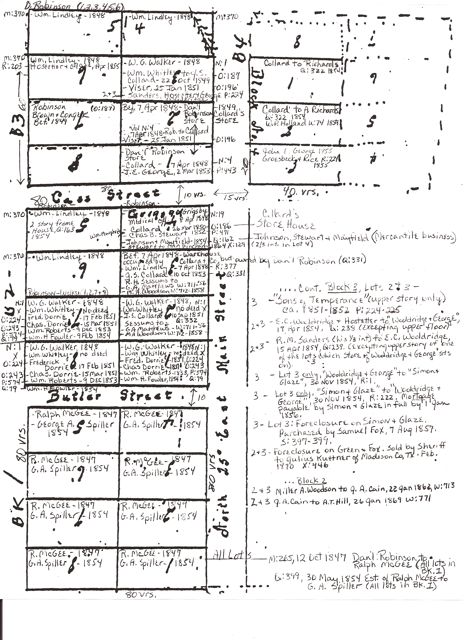
The vertical files in the Genealogy Dept. of the Montgomery County Public Library in Conroe held a reference to a plat of the town lots made on 10 July 1848 by Daniel Robinson and witnessed by John S. Besser, a local attorney. [A biography on John S. Besser can be found in the Walker County, Texas History Book, pg. 221.] It was filed in the Montgomery county courthouse on 11 March 1851 (Vol. O:231). The plat shows Blocks 1, 2 and 3 on the West side of Main St. and only 3 lots in Block 4 on the East side. Butler Street ran in between Blocks 1 and 2 and Cass Street ran between Blocks 2 and 3. It has been proven that the areas around Block 4 were already owned and possibly developed by other settlers by 1848, as will be shown later. It’s interesting to note that the written land description given on the plat does not account for two of the lots on the north end of Block 3, nor does it even mention Block 4 which was on the east side of Main St. even though part of it is drawn on the plat. It is obvious from further study that Block 2 on the West side of Main St. seemed to be the original center of activity. However, as will be shown in a detailed study of the Town Lots, the ownership of the lots changed hands fast and furiously during the Towns short lifetime. Once I had a copy of the plat from the deed records, we had somewhat of a starting point. At least we knew there had been a plan and there was indeed a Town or Business District as we had all heard and read about. On the Plat, a water well was used as a landmark for the location of the town lots. Daniel Robinson described the BEGINNING CORNER as being “the South East Corner of Lot No. 1, Block No. 1, which bears North 31 [deg.] West, 29 varas from the inner wall of Hiram Little’s Well.” And the blocks of lots were situated on ‘Main Street.’ However, without knowing where the well was located, we could not place Main Street or the town lots on the map. [A vara is a unit of measurement used in early Texas. 1 vara = 33-1/2 inches; 36 varas = 100 feet.]
The beginning line in the land description was actually the intersection of two well-known survey lines, giving us a definite starting point from which to place the Spiller property on the map. One of the coordinates also referred to a “corner near well” so we knew the general vicinity of a well on the property. Other descriptions in the deed referred to a point that was the “S. W. corner of B. E. Frasiers Lot, now Besser’s” (Besser just happens to be David Frame’s ancestor) and further describes other lines that went to “Blocks of Lots.” We knew at this point that some of George A. Spiller’s boundary lines were adjacent to the Town Lots of Danville. It was an exciting discovery. During the course of my own family history research, I found the original probate documents of my ancestor, George Anderson Spiller, which were in the Black Boxes at the County Clerk’s office in Conroe. One of the documents in this packet was a plat showing the measurements and acreage of two tracts of land that he owned when he died in Danville on 11 April 1854. One of those tracts contained 460 acres of land and clearly showed Main Street intersecting the west boundary of the land, placing Spiller’s tract on the east side of present day Old Danville Road. We knew from family tradition that his property was on present-day Old Danville Rd. So this was our first clue that Old Danville Road was originally called Main Street and was our first big break in being able to discover the true location of the Danville Town Lots and ‘Hiram Little’s well.’
Clearing of Well Site –
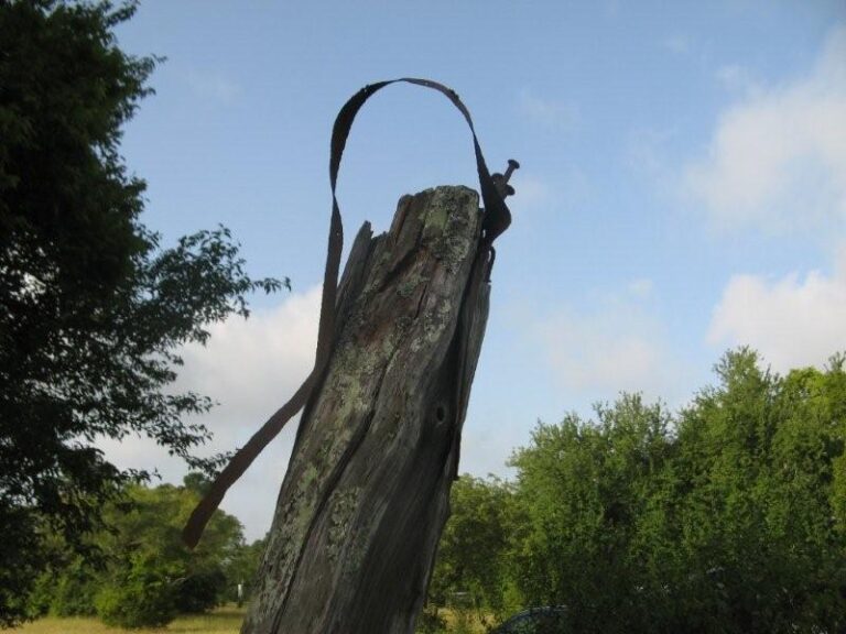
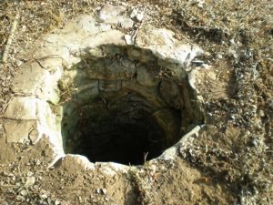
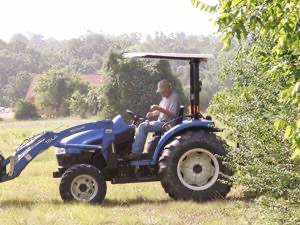
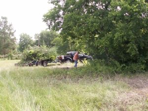
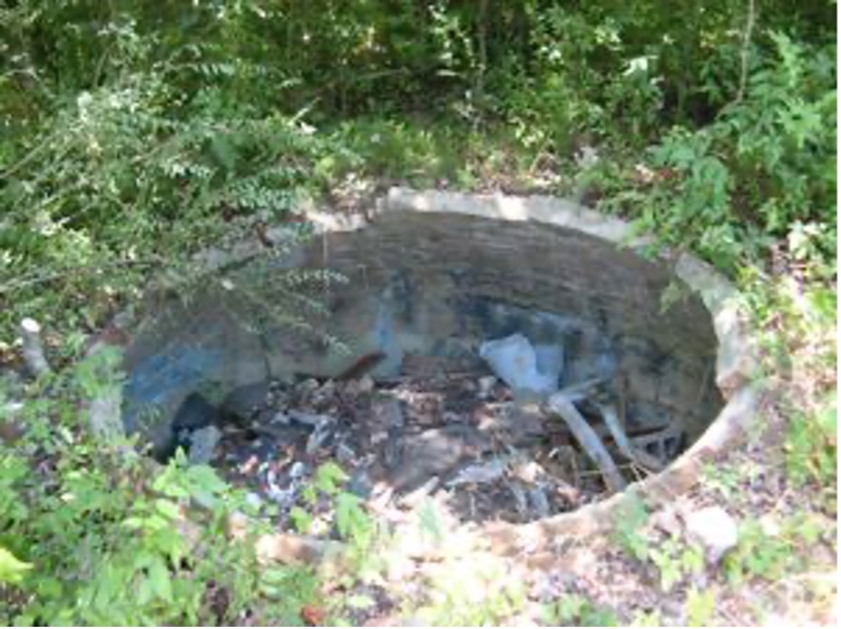
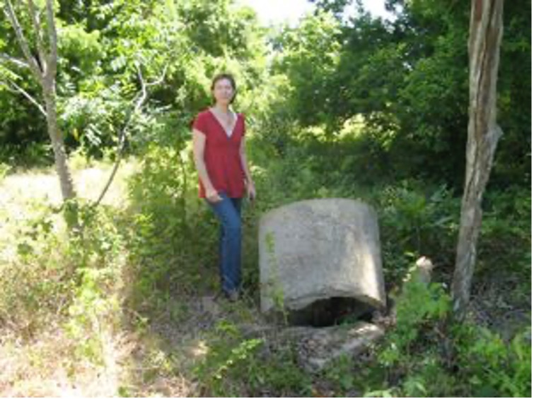
In 2008, I was fortunate to have a few opportunities to examine the well-head on the East side of the road on what had been Spiller property from 1852 to the early 1970s. What we discovered upon closer examination was the wonderful stone well or “Dug Well” as described by Russ Clanton. The area was overgrown and a sapling was growing up from the rim of the well and had pushed over the cement structure that covered the opening. But, it was no doubt the same well in the Clanton photo that marked the Spiller homestead. After discussions with the landowner, David Martin and I made plans to get back to the well and cistern site to clear the brush from around them and possibly remove the saplings from further damaging the structures. We also wanted to examine the structures more closely and document our findings with photographs. This site is on private property and is not accessible to the public. The brush clearing was done by Randy Brown (Danville Cemetery caretaker, at the time) and David Martin (Danville descendant and SRT member) on a hot Saturday morning. I could hear Butter, the neighborhood camel, making ‘camel’ noises down the road. It was a surreal feeling as I stood on land where my ancestors toiled over 150 years ago. I often yearn to be back in the 1850s in this very place for just a day or two…just to see what it looked like then. Daydreams aside, I watched as Randy and David gradually began to make the sites more accessible. I was watching carefully for snakes and poison ivy as well as clues left behind from long ago. The brush had grown fast and it was much more overgrown than the first time we had visited the site. A curious neighbor stopped by to see what we were up to and soon offered us the use of his tractor and brush hog. The kindness and feeling of community in this place speaks to my soul. David Martin had a grand time with the tractor and finally we were able to photograph the well and cistern structures more closely. The below photos show the opening of the well after we removed the cement base and ‘top’ from over the opening. The beautiful craftsmanship of the stonework is in wonderful condition.
Well Site –
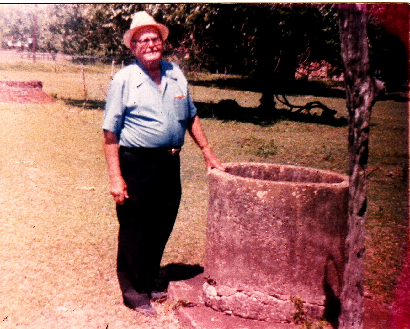
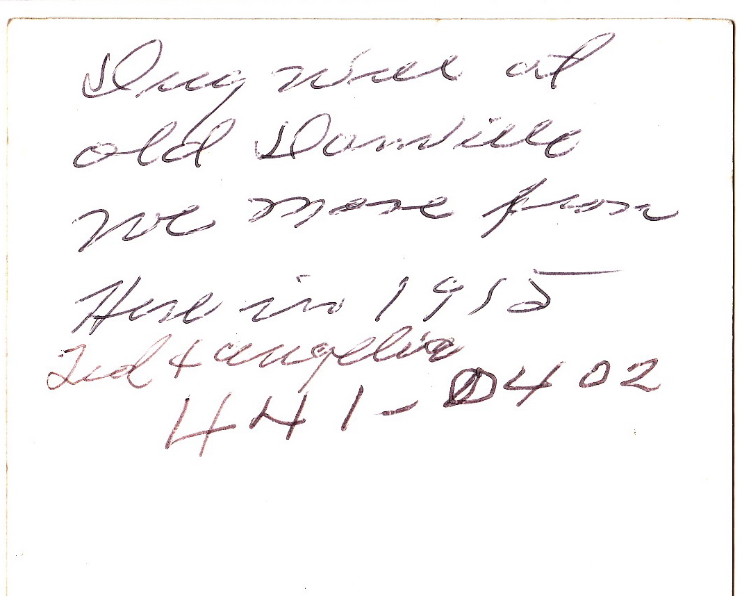
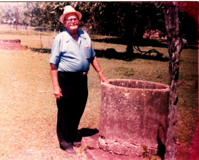
In 2007, my mother visited with Russ’ widow, Edith, at her antique store in Conroe. She gave my mother a wonderful photograph of Russ standing by the cement well-head on the ‘old Spiller place,’ as Russ had referred to it. In the background, a round brick structure can be seen along with a tree with a large vine growing up into it. The back of the photo reads “Dug well at Old Danville. We move[d] from here in 1915.” This was the well on the ‘old Spiller place’ and I felt sure that it was the same cement well-head I had seen on my drives around the area. But did this mean that Russ dug the well? This was not the case. Russ would have only been 7 years old when the Clanton family moved AWAY from that property. After conducting some research on water wells, Karen Hett found that a “Dug Well” is a TYPE of water well and is described as follows, “historically, being excavated by hand shovel to below the watertable until water exceeded the digger’s bailing rate. The well was lined with stones, brick, tile, or other material to prevent collapse, and was covered with a cap of wood, stone, or concrete.”
At this point, we did not realize that this particular well was the same well referred to in the Town Plan deed as “Hiram Little’s well.” But before our quest was over, we had proven it beyond a doubt. The area where the town site was located is now privately owned tracts of land with family homes, pastures, horses, and even a camel! Chris Alba owns property where the north end of the town lots on the west side of the road would have been. There is an old well on his property, but it could not possibly have been Hiram Little’s well as it is on the west side of the street that had been Main St. 157 years ago and the Town Plat locates Hiram’s well on the East side of Main and at the south end of the town.
In 2008, I was fortunate to have a few opportunities to examine the well-head on the East side of the road on what had been Spiller property from 1852 to the early 1970s. What we discovered upon closer examination was the wonderful stone well or “Dug Well” as described by Russ Clanton. The area was overgrown and a sapling was growing up from the rim of the well and had pushed over the cement structure that covered the opening. But, it was no doubt the same well in the Clanton photo that marked the Spiller homestead.
Recalling the other structure I had seen in the background of the photograph (visible on the left side of the photo of Russ), I had searched north of the well site, during an earlier visit, and under a large, brushy area found the remains of a large brick cistern, also in danger from debris and saplings. In one of George Spiller’s letters home to Virginia in 1851, he makes reference to the cisterns in the area and that “he would have one next fall” which would have coincided with his purchase of this property in 1852.
After discussions with the landowner, David Martin and I made plans to get back to the well and cistern site to clear the brush from around them and possibly remove the saplings from further damaging the structures. We also wanted to examine the structures more closely and document our findings with photographs. This site is on private property and is not accessible to the public.
Cistern –
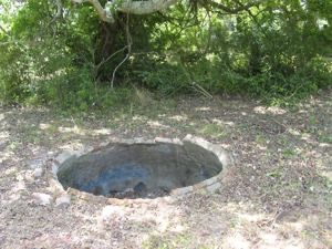
It’s possible that the stones in the foreground of the below photo of the cistern area were ‘leftover’ stones from the nearby well construction several feet to the south of the cistern site shown below. The cistern was constructed of handmade brick and lined with cement whereas the well shown in the photos above was constructed of stone. Many of the bricks broken off from the rim are now inside of the cistern leaving only a jagged edge of bricks around the rim. The cistern is full of debris.
Using the online tools provided with Google Earth, I recreated the measurements provided by Daniel Robinson’s 1848 Town Plat (29 varas S30E from the inner wall of Hiram Little’s well to the South East corner of Lot 1 in Block 1 of the Town) to confirm that the well on the old George Spiller property was ONE AND THE SAME as Hiram Little’s well. The measurement matched up perfectly to the location of the Town lots that had emerged on the map that David Frame had drawn from the deed record descriptions and measurements! After two years of work, we concluded that the well used as a reference point on the Town Plat was one and the same as the well on the 1852 Spiller property. We had found “Hiram Little’s Well” and we had proven the location of the Town of Danville! Subsequently, through an in-depth study of the deed records, it has been proven that this same well was referred to throughout the evolution of the Joseph Lindley Survey as 1) McGary’s Well, 2) Hiram Little’s Well and finally, as 3) Spiller’s Well and can be dated to ca. 1845 when Daniel and Sarah (Lindley) McGary received title to the tract. The progress of this research is detailed below. The study of the evolution of the Town of Danville and its surrounds is ongoing.
Finding the deed to Danville –
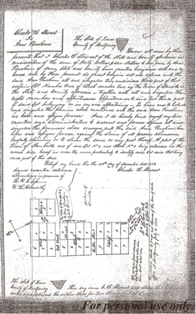
In early November 2008, the deed below was found in Deed Book X, pg. 135, of the Montgomery County Deed Records. The deed, dated 28 Dec 1864, is from Charles B. Stewart to Ann Pincham and involves the sale of a lot in the town of Danville. Charles Stewart was an attorney and drew up wonderfully descriptive deeds. In many of them, like this one, he includes a map or plat of the property. This plat shows the town of Danville as filed by Daniel Robinson in 1847, noting the Well used as a reference point or landmark. The Well is marked “Mrs. Spiller’s Well, formerly Little’s Well” confirming our findings. [This is a rare example of a Danville Town Lot sale during the Civil War years at which time the deed records reflect the difficulties faced through the number of deeds concerned with debts and bankruptcies.] Vol. X, pg. 135, Montgomery County, TX Deed Records.
The property containing the well, along with the town property can be further traced back by a chain of title on a tract of land that the original headright owner, Joseph Lindley, gave to his daughter, Sarah (Lindley) McGary, through a Gift Deed in 1845 (Vol. L, pg. 5, Montgomery Co., TX Deed Records). To understand fully, we must FIRST look at the evolution of the Joseph Lindley Survey itself.
The Joseph Lindley Survey~
On April 6, 1835, Lindley was awarded a Headright for 1 league of land (25,000,000 square varas) or 4,428.4 acres which he located in Montgomery Co., TX near the San Jacinto River. Several early Montgomery county deeds make reference to the area where he settled as “Lindley Settlement” or “Lindley’s Prairie.” The land which is the focus of my study is located within this headright now known as The Joseph Lindley Survey, A-25, on present-day maps. A few years after receiving the headright, as evidenced by the deed records, he began donating and/or selling pieces of his large tract of land, as follows:
- 9 Sep 1840 – Gift donation of 5 ac. to the Methodist Episcopal Church (Vol. F:116)
- 16 Oct 1841 – to Iredell Reding (K:19)
- 8 Nov 1845 – Gift donation of 320 ac. to daughter, Sarah McGary (L:5)
- Dec 1845 – to Samuel Lindley, Sr. (O:181)
- Dec 1845 – to Maneurah (Minerva) S. Evans (L:225)
- Mar 1846 – to Thomas McIver (L:169)
- Mar 1846 – to Benjamin Fielding Irvine heirs (L:180)*
- Mar 1846 – to Peter Belles Irvine (L:188)
- Mar 1846 – to William Harper Spillers (L:231)
- Mar 1846 – to William Waters Shepperd (L:232)
- Apr 1846 – to John Spillers (L:229)
- May 1846 – 3 ac. to the Methodist Episcopal Church (L:234)
- 18 May 1846 – to Andrew Park (N:2)
- Oct 1847 – to Mary Steptoe Shepperd (O:178)
- June 1849 – to Green Wood (N:204)
- Dec 1853 – to W. J. M. Towson (P:592)
Before concluding the disposition of all of his headright land, Joseph Lindley moved his family north to Limestone Co., TX ca. 1846. They settled slightly north of present-day Mexia, TX. Lindley died on January 20, 1874 and was buried in Limestone Co. However, his remains were later moved to the State Cemetery in Austin.
Benjamin Fielding Irvine died in 1844 before the deed for his land purchase could be finalized, thus when the deed was finally made and filed two years after his death, it was in the name of his heirs. But he owned the land at the time of his death as he had taken a mortgage on it from James H. Mitchell in 1841 (Bk. F:312). At that time the property had a house and gin and was located on present-day West Danville Road.
McGary Tract –
From the Joseph Lindley’s transactions, it is the tract that he gave to his daughter, Sarah (Lindley) McGary, as a gift on 8 Nov 1845, that contained the area where the Town of Danville was located and also the homestead of my Spiller ancestors. The land that was to become the Spiller homestead was a 460 acre tract purchased on 20 Feb 1852 (P:344) from Jonathan S. Collard; part of which was in the McGary tract within the Joseph Lindley Survey. The Spiller’s actual home was located on the East side of Main St. in Danville (now Old Danville Road). Recall from the analysis of Joseph Lindley’s first sales out of his headright that he made a Gift Donation of 320 acres of land to his daughter, Sarah McGary, in Nov 1845 (L:5). The Town Lots adjacent to the Spiller land were also contained within the McGary tract so further study of the evolution of this tract was done, as follows:
Out of the McGary’s 320 acres, the following series of sales were made:
1) 164 ac. of the 320 ac tract was sold to JOHN TUCKER (L:16-17, 10 Dec 1845).
JOHN TUCKER sold the same 164 ac. tract to W. W. SHEPPERD (M:193-194, 30 Jul 1846)
W. W. SHEPPERD sold 93.5 ac. (of the 164 ac.) to J. S. COLLARD (M:175-177, 7 Apr 1847)
W. W. SHEPPERD sold 12.5 ac. (of the 164 ac tract) to HIRAM LITTLE (N:81-82, 21 Sep 1848)
J. S. COLLARD sold the 93.5 ac tract to HIRAM LITTLE (N:82-83, 1848) “except one town lot of 1/2 ac. West and South of the May [Way] survey and except also 2 Town Lots in Danville to contain 1600 sq. vr. of land, the lines to run according to the plan of the Town of Danville and to include the house first used as a storehouse by Collard & Co.”
W. W. SHEPPERD sold the remaining 58 ac (of his 164 ac tract) to DANIEL ROBINSON (M:296, 12 Jul 1847). It was within this 58-ac. tract that most of the Town Lots of Danville were located.
Conclusion of series of sales of the 164 acres: Out of the 164 ac. of the McGary tract, HIRAM LITTLE ended up with a 93.5 ac. tract and a 12.5 ac. tract. DANIEL ROBINSON ended up with 58 ac. (totals 164 ac.). This does not include the sales of individual lots in the Town which will be discussed later. 2) Now the for the remaining 156 ac. of the 320 ac. McGary tract:The entire remaining tract of 156 ac. was sold by the McGARY’S to HIRAM LITTLE (M:373-374, 30 Oct 1847). Finally, on 1 Jan 1850, HIRAM LITTLE sells out to JONATHAN S. COLLARD the following tracts which total 262 acres: 156 ac., 12.5 ac. and 93.5 ac. with specified exceptions…2 town lots sold to James Springston and 1 town lot on which the grocery store stands, 1-8.5 ac. tract sold to Robert Kelton, 1 ac. sold to G. B. Pursley. (The deed from J. S. Collard to G. B. Pursley was never recorded so this exception and a few other references to it in other deeds is our only evidence of the location of this tract.)
Final tally of the division of the 320 ac. McGary tract by 1850 (not including lots in the Town site):
262 acres owned by JONATHAN S. COLLARD with exceptions noted above, and 58 acres owned by DANIEL ROBINSON, not including Town lots.
The map represents the original division (1847-1850) of the McGary tract and the approximate location of the Danville Town Lots. I drew this rendering from the original mapping done by David Frame, which will be presented later, in order to show the original chain of events which led us to the discovery of the well and the town site. The Town Lots were being sold as early as 1847 and there were other sales adjacent to the townsite during this period which will be discussed in more detail in a later section. Note that the southern boundary of this tract is present-day Shepard Hill Road. And the western half of the northern boundary is approximately the location of present-day West Danville Road. The line between the 58-ac. tract and the 93.5-ac. tract where the townsite is located is present-day Old Danville Road (called the Montgomery – Swartwout Road and later, Main Street).

Danville Town Site –
For about two years David Frame was busy trying to draw a map of the land ownership in the Joseph Lindley from the disjointed land descriptions I was furiously sending him as I found them. The manner in which I was approaching this task was very disorganized but, quite frankly, I did not start out to map or study the Town of Danville or its environs. This was happening spontaneously as we found more and more information which lead to more and more questions we wanted to answer. My goal has been family history and specifically, to learn more about the land and history of the Danville Cemetery since I had been given, or ‘graciously accepted’ I should say, the responsibility of overseeing the maintenance of the cemetery. Suddenly, or so it seemed, we were researching Danville for a series of articles to be written by Karen Hett for the upcoming “Herald” periodical published by the Montgomery County Genealogical & Historical Society in the Summer of 2008 and for a possible article to be included in the new History Book also being published by the Society and having a marvelous time doing it! Finding the TRUE location of the Town site became imperative and up to this point we had been unable to place the Town Site on the map without some sort of known ‘anchor’ point to tie it to on the map. Finding the location became even more important for me, personally, for my family history, when I examined the original probate documents of my ggg grandfather, George Spiller, located in the infamous “Black Boxes” in the County Clerk’s office in Conroe. Within these documents I found an original plat of the land that he owned at the time of his death in 1854. This plat showed that MAIN STREET intersected the east end of his 460 ac. tract of land. We knew from the recorded plat that the Town site was on Main Street so I pulled the deed wherein George Spiller had purchased his property from J. S. Collard in 1852 (P:344). The land description was wonderful and clearly tied the 460 acre tract to established survey lines on the east boundary. This was the technical information David needed to tie it down on the map. The land description also clearly indicated that the 460 ac tract was adjacent to the town lots…….we had located the Town! As the puzzle pieces fell into place, we were also delighted to discover that the well referenced in this deed was the same well used as a landmark on the town plat!
The 1854 plat below shows George Spiller’s 460 acre tract with Main Street intersecting the east end of the property.

Danville Town Lots within the McGary Tract of the Joseph Lindley Survey –
Updated Map of Danville Town Lots-2012
The Danville area was fluid until the Civil War and there was much land speculation. Many folks today picture Danville as only the town lots as seen on the plat filed in the courthouse. But there was much more to Danville than Town Blocks 1 – 4. The other movers and shakers of early Danville failed to file many of their deeds and thus have made the task of mapping the land ownership more challenging. As I analyzed the filed deeds, it became clear that there was development on both sides of Main Street; Daniel Robinson owning the part on the West side of Main. An interesting side note about Daniel’s town plat is that he has drawn an incomplete block of lots for Block 3 and 4. Block 3 shows only 6 of the traditional 8 lots on the west side of Main. Block 4, on the East side of Main St., shows only 3 lots and is not even mentioned in the land description. This tells us that at the time Daniel filed this plat others had already developed the East side of Main St. and there is no indication that he ever owned any of the lots in Block 4. In fact, deed records show that Jonathan S. Collard owned the land on the east side Main at that time and it was Collard who sold the first lots in Block 4. There will be more discussion of Block 4 later. Daniel’s ownership clearly seemed to be contained to Blocks 1-3. The absence of 2 of the lots on the north end of Block 3 is probably because he had already sold them to Wm. Lindley at the time he made the plat. It appears that Daniel was rushing to file this plat in order to go on record as the developer of the new town of Danville, TX. It’s also interesting to note that he didn’t stay around in the area very long. He filed the plat in 1848 and obviously finished selling all the lots within the next two years. By 1850 he is found on the Harris Co., TX census; occupation “Lumberman.” From a son’s biography we know that Daniel died in Texas, probably in Harris County, in 1854 or 1855. 
Ownership of Danville Town Lots –
The Danville area was fluid until the Civil War and there was much land speculation. Many folks today picture Danville as only the town lots as seen on the plat filed in the courthouse. But there was much more to Danville than Town Blocks 1 – 4. The other movers and shakers of early Danville failed to file many of their deeds and thus have made the task of mapping the land ownership more challenging. As I analyzed the filed deeds, it became clear that there was development on both sides of Main Street; Daniel Robinson owning the part on the West side of Main. An interesting side note about Daniel’s town plat is that he has drawn an incomplete block of lots for Block 3 and 4. Block 3 shows only 6 of the traditional 8 lots on the west side of Main. Block 4, on the East side of Main St., shows only 3 lots and is not even mentioned in the land description. This tells us that at the time Daniel filed this plat others had already developed the East side of Main St. and there is no indication that he ever owned any of the lots in Block 4. In fact, deed records show that Jonathan S. Collard owned the land on the east side Main at that time and it was Collard who sold the first lots in Block 4. There will be more discussion of Block 4 later. Daniel’s ownership clearly seemed to be contained to Blocks 1-3. The absence of 2 of the lots on the north end of Block 3 is probably because he had already sold them to Wm. Lindley at the time he made the plat. It appears that Daniel was rushing to file this plat in order to go on record as the developer of the new town of Danville, TX. It’s also interesting to note that he didn’t stay around in the area very long. He filed the plat in 1848 and obviously finished selling all the lots within the next two years. By 1850 he is found on the Harris Co., TX census; occupation “Lumberman.” From a son’s biography we know that Daniel died in Texas, probably in Harris County, in 1854 or 1855.
The town began to decline during and after the Civil War. In Book W of the Montgomery County Deed Records one can sense the dismal picture of life in Danville. Many folks filed for bankruptcy or mortgaged their crops to others for goods and services, or for loans. Many just gave up, sold out and left the area. Research shows that some went back “home” and others moved to different areas of Texas. We also see the beginning of share-cropping during this period. Survival was the name of the game. Some of the local families lost their husbands, fathers and sons to the war. They also lost their slaves and therefore their farm labor. Many lost their homes, farms and businesses to financial ruin. Some, undoubtedly, also lost their will to live and subcumbed to depression, illness and death. The remainder of this story will be about those individuals who stayed in the Danville area … adapted to the changed order of their lives and decided to stay in this part of Texas that had become their home. We’ll look at the land ownership of the area through the demise of the Town Lots to the turn of the century when Danville became “Old Danville” and we’ll talk about some of the families who stayed. The ‘journey to Danville’ will continue …